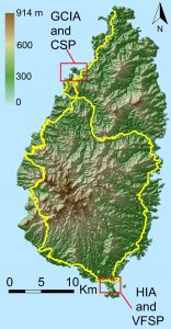
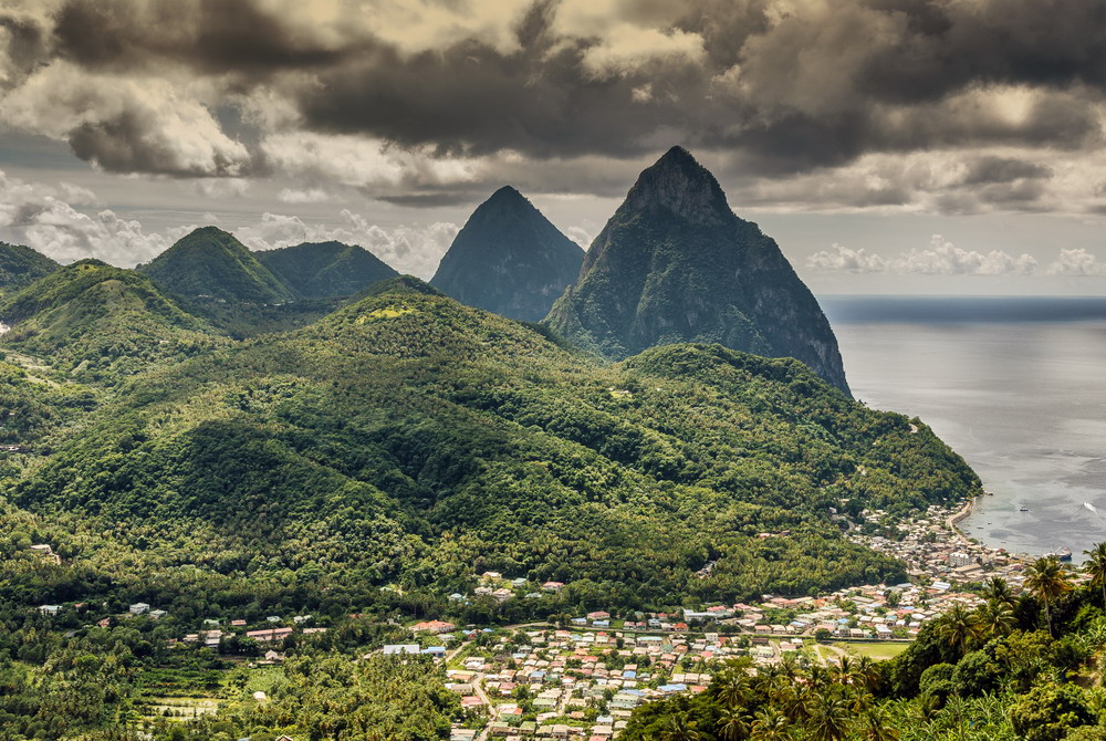
Saint Lucia is a Small Island Developing State (SIDS) located at the Lesser Antillean Arc of the Caribbean Archipelago with a total resident population of 185,000 in 2015. The island is of volcanic origin. This has resulted in a mountainous and rugged topography, characterized by steep slopes cut by fast-flowing water drainage networks, confined low-lying coastal areas and ‘pocket’ beaches. Saint Lucia is an open economy which has progressed within the context of a relatively stable social and political environment. The island’s economy is vulnerable to global economic shocks (such as the global financial crisis in 2008), fossil fuel price hikes, and changes in international trade and tourism preferences. In addition, due to its geological and climatic characteristics is subject to natural disasters.
While Saint Lucia’s small size and high degree of openness have made it vulnerable to external economic shocks, its geographic location, climate and geology have also made it susceptible to natural hazards. The island is vulnerable to hydro-meteorological (e.g. high winds, excess rainfall, hurricanes) and geophysical events (e.g. earthquakes, volcanic activity), the impacts of which can be severe and pronounced by the island’s small economy; historical information indicates that storm-induced flooding and landslides have been the most likely hydro-meteorological impacts affecting Saint Lucia. Average annual economic losses associated with extreme hydro-meteorological events for the period 1992-2011 have been equivalent to roughly 2 % of GDP or about US$ 26.94 million PPP. However, singular high-impact events can be devastating: Hurricane Allen (1980) have resulted in damages/losses equivalent to about 60 % of GDP while the recent Hurricane Tomas (2010) resulted in damages/losses estimated as US$ 336.2 million (43.4 % of GDP).
 Key economic and critical infrastructure assets in the country including the airports, seaports and fuel storages, are all located along the coast or on low-lying reclaimed coastal land. Thus, transport infrastructure is vulnerable to the impacts of climate change, as is exposed to both coastal and inland flooding, which is further exacerbated by Saint Lucia‘s topography.
The report on the St. Lucia case study contains the following components:
Chapter 2 present the country profile of St. Lucia, including information on the island’s geography, and the socio-economic profile.
Chapter 3 provides existing climate and historical trends, as well as climate projections.
Chapter 4 demonstrate the criticality of transport infrastructure in St. Lucia, including the road network, and its two main airports and seaports. Critical coastal transport infrastructure considered in depth as part of this study include the George Charles International Airport (GCIA) and Port Castries seaport (CSP) located in the capital Castries; as well as the Hewanorra International Airport (HIA) and Vieux Fort Seaport (VFSP), both situated at the southern coast of the island.
The details on asset vulnerability/sensitivity to climate variability and change can be found in chapter 5. The aspects addressed include historical impacts/disruptions, future disruptions, using the “operational thresholds” method developed as part of the methodology, vulnerability to coastal flooding, as well as indirect impacts of climate change and the effect on tourism.
As part of the Saint Lucia case study, a beach retreat prediction methodology was also used to assess the range of long- and short-term beach retreats/erosion for different beach slopes in Saint Lucia, as well as sediment textures (grain size) and wave conditions, under different scenarios of mean sea level rise changes and/or storm induced sea level rises.
Finally, potential approaches to adaptation are presented in chapter 6.


